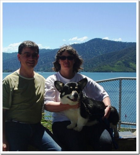
After the Alexandra Show, where Monty got Best of Breed, we headed up to the Lake Eildon [^] dam wall at Eildon. After a wet year the lake is almost full, something that has only happened six times in the past 50 years [^].
Melbourne
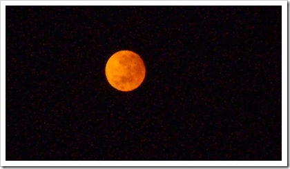
Bush Fire Moon
With the recent Victorian Bushfires (Bush Fires, Update, Contained) we have had some wonderful sunrises and sunsets. I managed to get this photo from our back steps, just above our next-door neighbour’s roof.

The only good vantage point I had for a sunrise was through the kitchen window. The fly-screen meant that I ended up with strong strobe effect, so no joy there.
The Victorian Bushfires are Contained
A day of heavy rain has meant that the last of the bushfires [^] that raged across the state for five weeks is now controlled. The fires have claimed 210 lives, more than 2,000 homes and burnt 421,000 hectares.
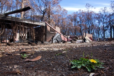
Two weeks ago we drove up to the farm, along the Melba Highway. On the way we passed close to the Kinglake township and through Yea, some of the areas most effected by the fires. The change in the landscape is almost unbelieveable; stark burnt trees and bare earth have replaced the lush, overgrown forest floor.
From the highway there are signs of frantic fire-fighting efforts, especially around Glenburn, and around odd farmhouses. But, the human-scale of the loss, lives and houses, is hidden from view.
Neil Creek, a Melbourne photographer, was invited into the town of Kinglake [^]. He has the story of his visit, photos and some details of how the town was affected, as told by a local, on his blog.
Neil has also written an article on the Digital Photography School site [^], called “Photographing a Tragedy [^]“. The post emphasises the need for respect and tact in this situation, and fills in more of the Kinglake story.
Photo Credit: Neil Creek – Creative Commons License
Victorian Bush Fire Update
It is now almost a month since the bush fires started. It is important to remember that some of those fires are still burning uncontrolled. People are continuing to loose their homes and livelihoods, but hopefully not their lives.
There is some hope now that the break in the weather, and the forecast week of showers may enable firefighters to get on top of the fires. It is still expected that some blazes will need to be allowed to burn themselves out.
The Victoria Fires Map [^] , which is based on live data received from the official sites, is still showing lots of uncontrolled fires. But in a positive light we now have a Victorian Bushfire Events Map [^] for fundraising events, co-ordinated by the Victorian Premier’s Department.
Victorian Bush Fires
News of the Victorian Bush Fires seems to be getting good coverage around the world now.
Whole towns have been lost to fire, with hundreds of thousands of hectacres burnt. The death toll so far has exceeded that of the Ash Wednesday fires in 1983, with the toll expected to rise further as the emergency services begin to get into affected areas. This make this Victoria’s worst bush fire so far.
The CannibalRabbit family have not been directly affected by the fires. Mrs CannibalRabbit’s parents are in country Victoria, and like us are surrounded by nothing more than smoke at the moment. We have had some fires around 25 kilometres away from us at Yarra Glen, but other than the smell of smoke on the air and the loss of our view, we have nothing to worry about here in suburbia.
There are a number of reliable sources for news:
In response to requests by the CFA and the DSE that web-traffic too their sites be kept to a minimum, Google have created a flash-based map for people not threatened by the fires. The Victoria Fires Map [^] is based on live data received from the official sites.
Out thoughts go out to those affected by the fires, and our thanks to everyone involved in fighting the fires and those that are supporting them.


You must be logged in to post a comment.